Six problems, from a protected area to the whole of Europe
Each case answers the same five questions: what the problem was, what data existed, what intelligence was built, with which technology, and what changed because of it.
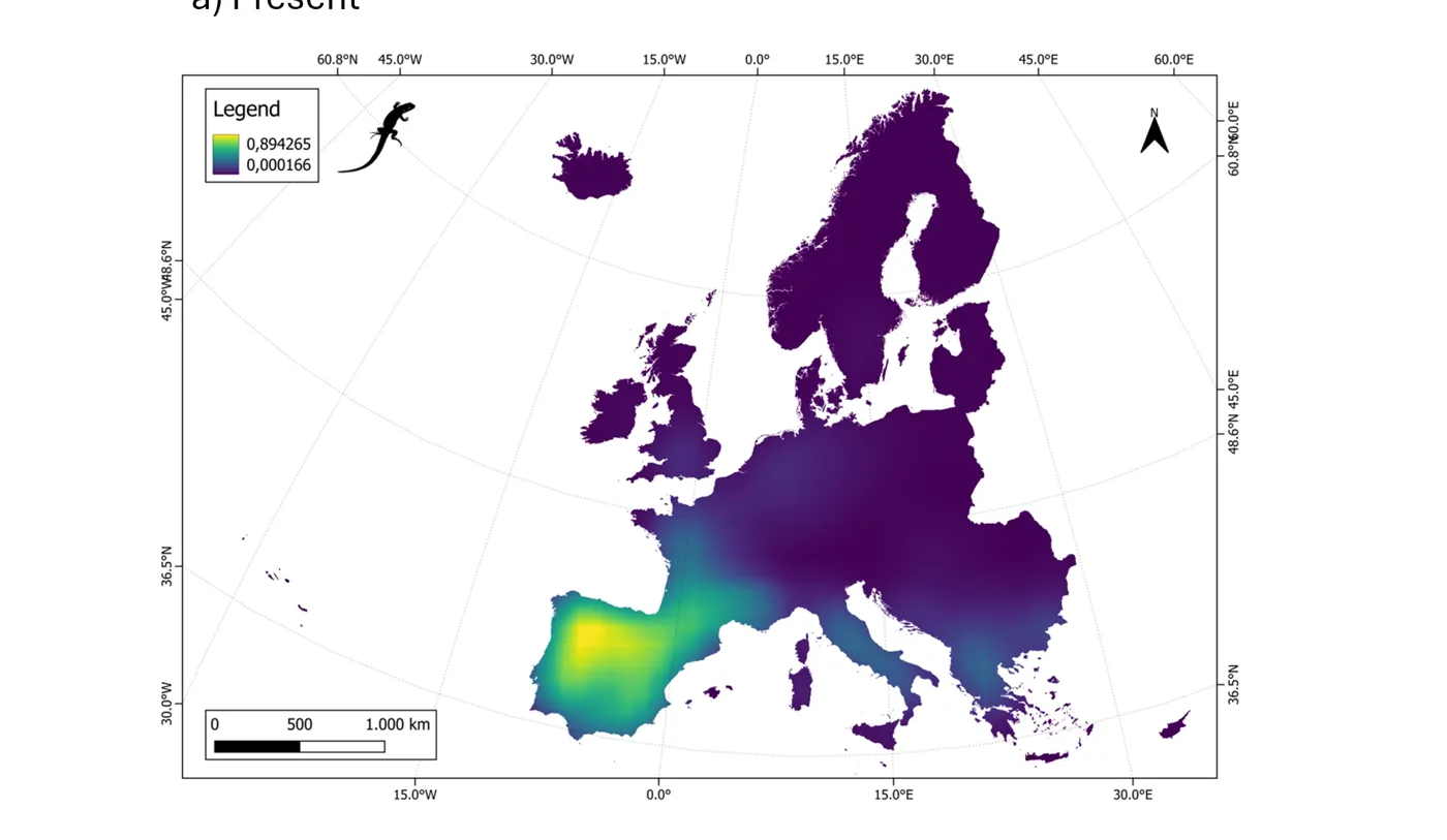
Forecasting biodiversity futures
Multi-scenario models linking climate pathways, land-use allocation and 10,000+ species to forecast biodiversity across Europe.
- 10,000+species in the nested SDM framework
- ~1,200European species forecast at high resolution
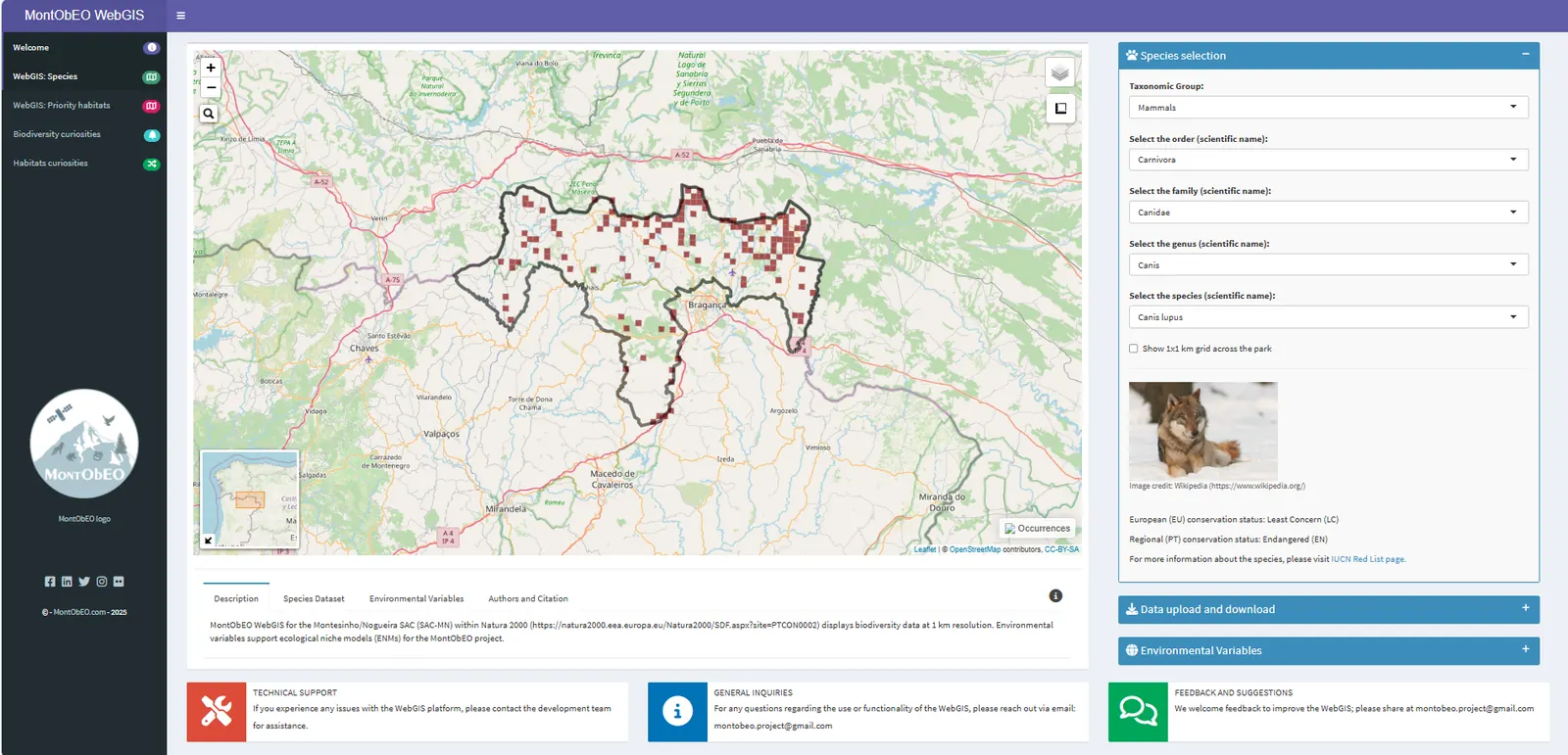
Biodiversity intelligence platform for a protected area
An R Shiny WebGIS mapping 1,312 species across the Montesinho/Nogueira SAC, used by 40+ stakeholders including ICNF and local authorities.
- 1,312species mapped in the WebGIS
- 40+stakeholders supported (ICNF, municipalities, local actors)
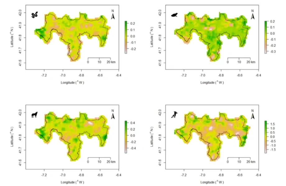
Reading twenty years of habitat change from orbit
MaxEnt niche models driven by satellite time-series in Google Earth Engine, revealing where potential species richness rose or fell between 2001 and 2021.
- 10,190species records used to train the models
- 2001–2021years of satellite observations analysed
GIS → operational intelligence for a forestry company
Geospatial workflows, dashboards and work-order systems that cut manual mapping time by ~40% and operational errors by more than half.
- ~40%less manual mapping time
- >50%fewer operational errors
Domain expertise inside AI systems
Reviewing AI outputs on land-use planning, impact mitigation and environmental decisions so that models learn what actually holds up in practice.
Read the case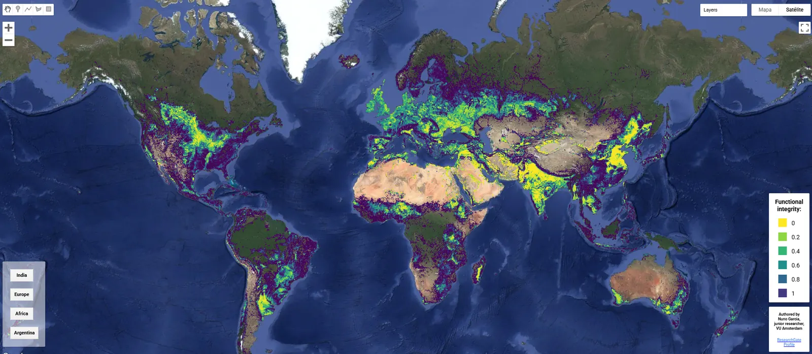
Making a global threshold explorable
A browser app that lets anyone explore where human-modified landscapes fall below the habitat share needed to sustain Nature's Contributions to People.
- 20–25%(semi-)natural habitat per km² needed to sustain NCP
- One EarthCell Press, 2024
Where the work happened
Two countries, one protected area studied for four years, and a continent modelled at one-kilometre resolution. Pick a place.
-
- Biodiversity forecasting for Europe
- Climate & SSP scenarios
- CLUMondo land-use modelling
-
- Biodiversity WebGIS for 1,312 species
- Satellite niche models in GEE
- Atlas & open dataset
-
- Forestry GIS & remote sensing
- Dashboards, ODT workflows, Monday.com
- NIS 2 compliance
-
- MSc Environmental Sciences & Technology (18/20)
- Thesis on GEE, niche models and WebGIS
-
- BSc Biology
- Student biology network — events & outreach
-
- Logistics & telecoms support for civil protection
- Remote AI-evaluation work (Labelbox / Alignerr)
The same question at six scales
Sensor → planet → continent → country → landscape → site. The tools change; the logic (observe, model, decide) doesn't.
- Satellite Time-series from MODIS/Landsat in Google Earth Engine Twenty years of habitat change read from orbit
- Global Functional-integrity thresholds across human-modified landscapes 20–25% natural habitat per km² — a GEE app to explore it
- Continent Europe at 1 km: species forecasts under climate and SSP pathways 10,000+ species in nested SDMs
- Country Portugal — from protected-area science to forestry operations National and European conservation-status reconciliation
- Landscape A protected area: richness, suitability, scenarios for 2050 Rewilding vs agroforestry in Montesinho
- Site A parcel and a crew: the work order that goes out tomorrow ODT templates, approvals, dashboards