Questions, methods, and what they became
Each entry gives the context, the question, the method and my contribution. Where a paper produced a tool you can open, the link is there.
-
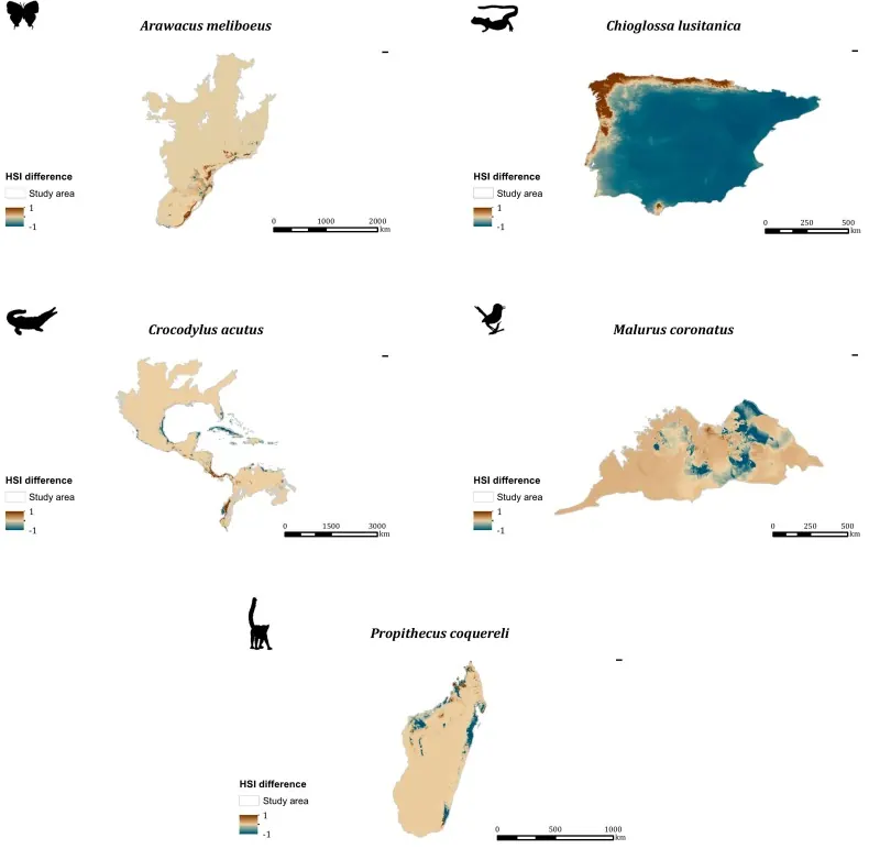
Ecotrends: an R package for estimating habitat suitability trends over time
- Question
- How can temporal trends in habitat suitability be analysed with a standard, reproducible workflow?
- Method
- An R package providing standardised trend methods and publication-quality outputs.
- Contribution
- Co-author on the package and paper.
- Impact
- Improves transparency and comparability of habitat-trend analyses across studies.
-
Global and local future connectivity trends reveal potential mixed contribution of protected areas to species range shift
- Question
- As species shift their ranges under climate change, do protected areas help or hinder the connectivity they need — globally and locally?
- Contribution
- Co-author.
-
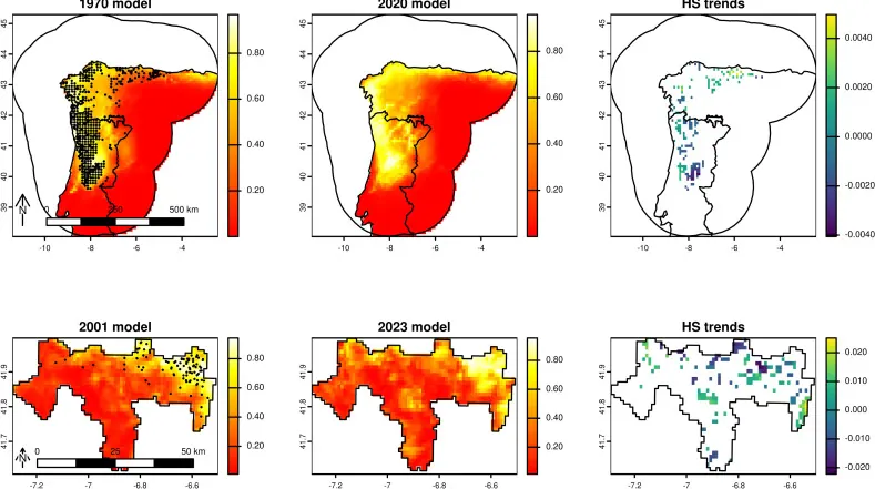
Time-series niche modelling reveals declining tendencies of habitat suitability and ecological functions in a mountainous protected area
- Method
- Time-series ecological niche models tracking habitat suitability and ecological functions over time in a mountain protected area.
- Contribution
- Co-author.
-
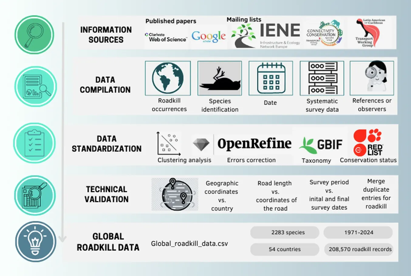
Global Roadkill Data: a dataset on terrestrial vertebrate mortality caused by collision with vehicles
- Contribution
- Collected and curated regional roadkill records, standardised taxonomic and spatial information, validated road proximity and documented metadata.
- Impact
- Extended the geographic coverage and reliability of a global dataset used for wildlife–vehicle collision analyses.
-
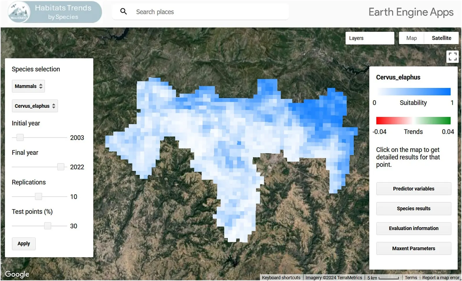
Montrends: A Google Earth Engine application for analysing species' habitat suitability over time
- Method
- Time-series remote-sensing data and species occurrences integrated inside a GEE application framework.
- Contribution
- Assembled and processed the time-series and occurrence data, wrote automated trend-indicator scripts, tested the interface and documented the workflow for reproducibility.
- Impact
- A browser-based tool for monitoring species habitat trends without local processing.
-
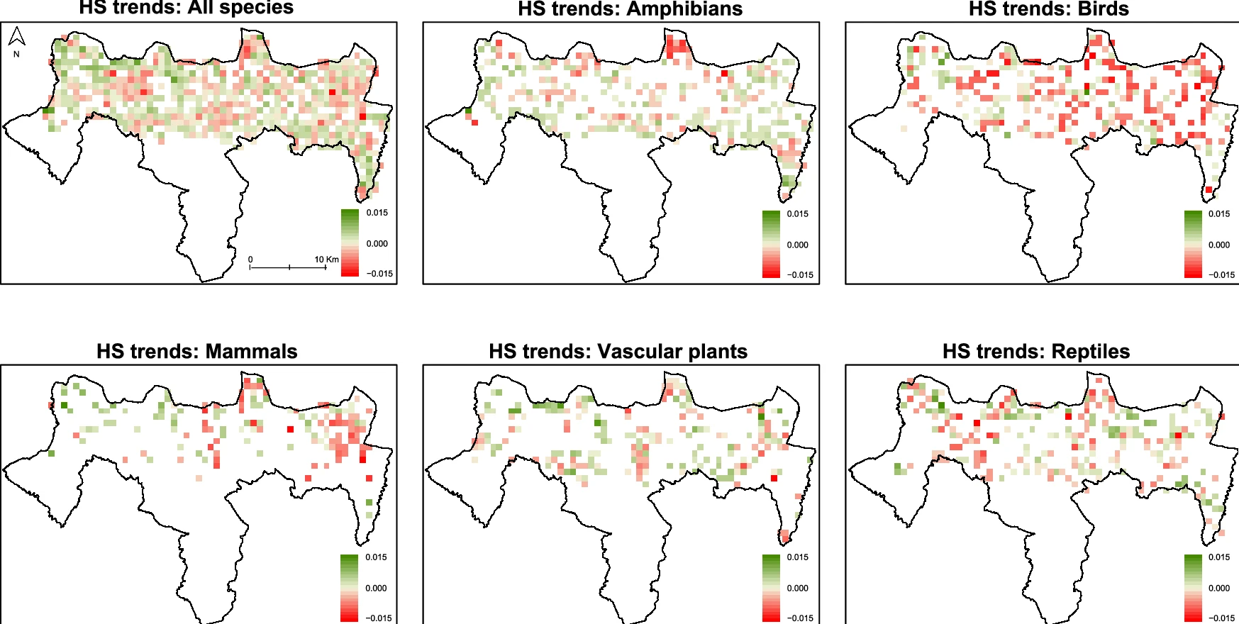
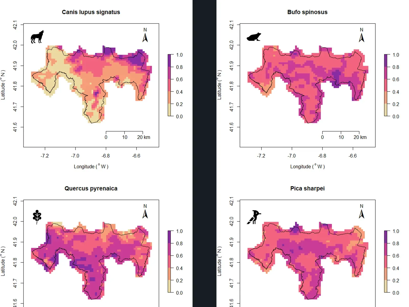
Assessing spatial and temporal trends over time in potential species richness using satellite time-series and ecological niche models
- Context
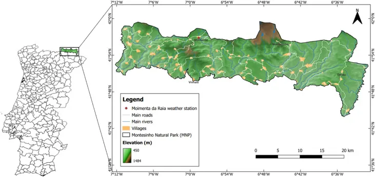
- The Montesinho/Nogueira Special Area of Conservation (SAC-MN, Portugal) had no repeatable way to track where species-rich areas were gaining or losing habitat.
- Question
- Can satellite time-series drive niche models to map how potential species richness changed between 2001 and 2021?
- Method
- MaxEnt niche models trained on 10,190 species records with satellite-derived predictors in Google Earth Engine; Mann–Kendall trend tests on the resulting potential species richness (PSR) surfaces.
- Contribution
- Lead author — designed the workflow, built the GEE models and trend analysis, wrote the paper.
- Impact
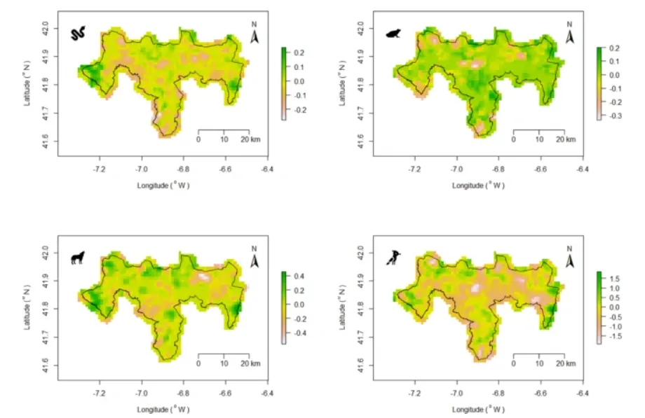
- PSR increased in eastern and western parts of the SAC but declined centrally, with different trajectories per taxonomic group — a spatially explicit signal conservation planners can act on.
-
Biodiversity dataset and atlas of the Special Area of Conservation Montesinho/Nogueira, Portugal
- Context
- Species occurrence and conservation-status information for PTCON0002 was scattered across regional and European sources.
- Question
- What does the biodiversity of the SAC actually look like when all available records are compiled, cleaned and mapped?
- Method
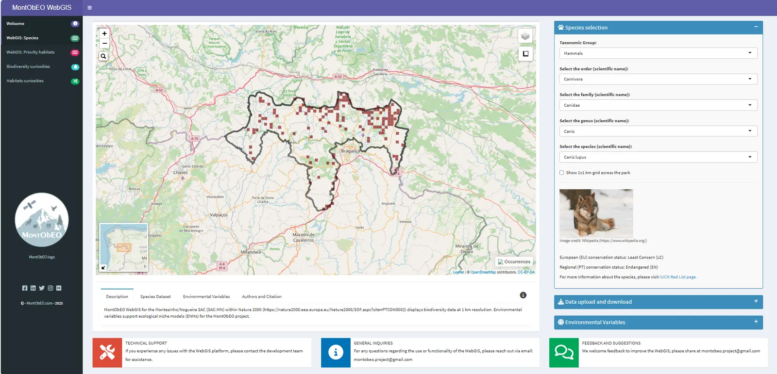
- Extensive data compilation from Portuguese and European sources, standardisation of taxonomy and conservation status, and an R Shiny WebGIS for navigation.
- Contribution
- Led the publication — data compilation and preparation, and the design and development of the WebGIS.
- Impact
- A single open dataset and atlas for a protected area used by ICNF, municipalities and local actors.
-
Dynamic shifts of functional diversity through climate-resilient strategies and farmland restoration in a mountain protected area
- Question
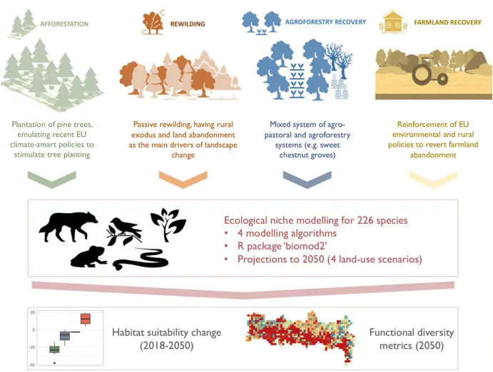
- How do afforestation, rewilding, farmland and agroforestry scenarios for 2050 change habitat suitability and functional diversity in Montesinho?
- Method
- Ecological niche models for 226 species projected under four land-use scenarios.
- Contribution
- Co-author — scenario modelling support.
- Impact
- Rewilding delivered the largest biodiversity gains; agroforestry increased landscape resilience — arguing for combining both.
-
Securing Nature's Contributions to People requires at least 20%–25% (semi-)natural habitat in human-modified landscapes
- Context
- Earth Commission work on how much (semi-)natural habitat human-modified landscapes need to keep delivering ecosystem functions.
- Question
- Is there a minimum share of natural habitat per km² below which Nature's Contributions to People break down?
- Method
- Global synthesis of NCP responses to habitat share across human-modified landscapes.
- Contribution
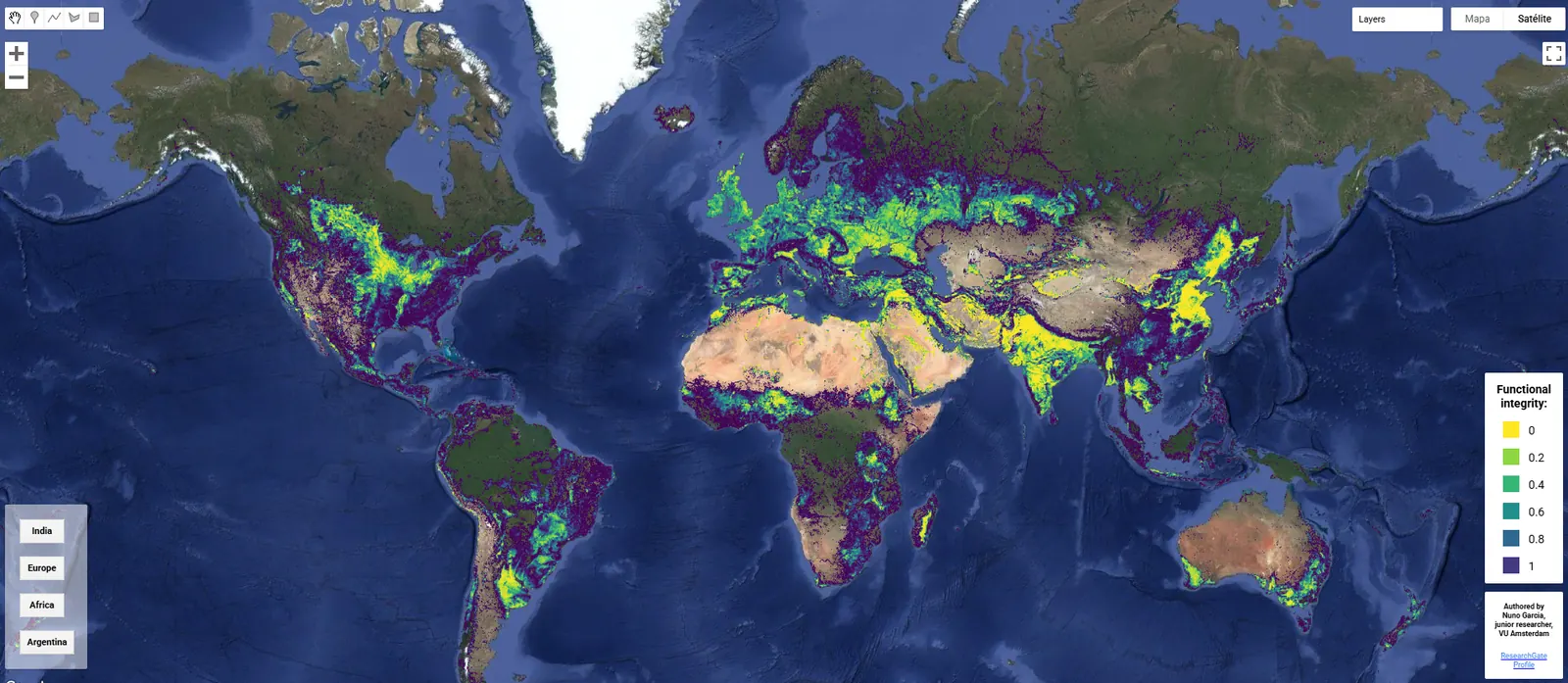
- Contributed to the study and built the Google Earth Engine application that makes its results explorable by researchers, policymakers and the public.
- Impact
- Identified a 20–25% per-km² threshold now used as a reference point in landscape planning discussions.
-
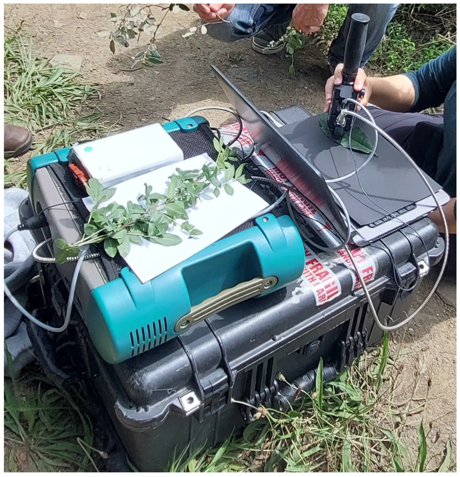
Spectral Library of Plant Species from Montesinho Natural Park in Portugal
- Contribution
- Contributed to building the spectral library.
-
Ecological Niche Models using MaxEnt in Google Earth Engine: Evaluation, guidelines and recommendations
- Question
- Can MaxEnt niche models run in Google Earth Engine match the desktop software — and where do they differ?
- Method
- Statistical and spatial comparison of GEE and MaxEnt outputs; identification of missing parameters in cloud implementations.
- Contribution
- Co-author.
- Impact
- Guidelines that let niche models run at cloud scale with known trade-offs.
-
Time-series analyses of land surface temperature changes with Google Earth Engine in a mountainous region
- Method
- Land surface temperature time-series in GEE, decomposed by season and topography.
- Contribution
- Co-author.
- Impact
- Showed how topography and seasonality shape LST trends and vegetation response in a mountain landscape.
-
Using Google Earth Engine, ecological niche models, and a web geographic information system for biodiversity monitoring
- Method
- Satellite-based niche models (SRS-ENMs) in GEE for the major taxonomic groups of the SAC, and an R Shiny WebGIS mapping 1,312 species and richness patterns.
- Contribution
- Author.
- Impact
- A transferable framework for conservation planning that seeded the atlas paper, the WebGIS and the richness-trend paper.